


INTERPRETIVE TRAILS FOR WALKING AND LEARNING
By: Chile Travel - 14 April, 2021
By: Solange Passicot | Date: 19 January, 2021 | In: Blog , Nature ,
Interpretive hiking is a non-competitive sports activity that tells a story along a trail where you will find different signs that share information about the nature around you and about ethnographic and cultural elements present in the area.
In general, these hiking routes go through old forest trails and are often facilitated by walkways and ramps, provided that the environment is respected. It is a symbiosis between sports, culture and environment.
The activity emphasizes the importance of providing knowledge of the most significant elements of the area’s flora, fauna, geology, history and archaeology. In so doing, you can live a much more complete and enriching experience.
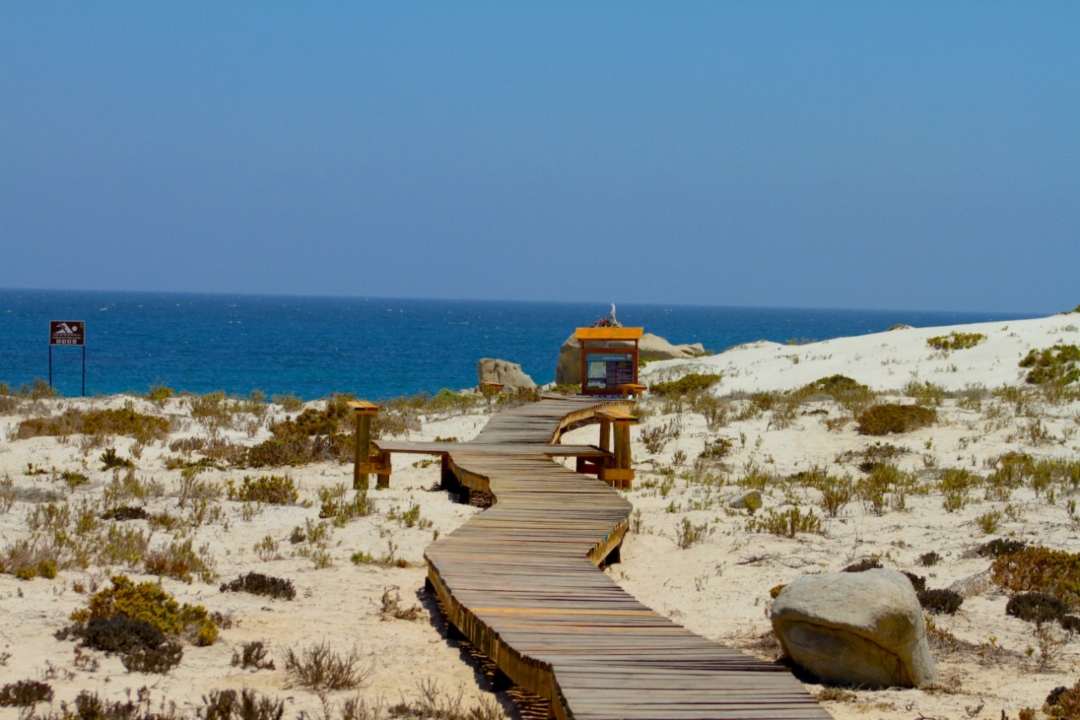
LLANOS DE CHALLE

Foto: Conaf
In the north of Chile, in the Atacama region, next to the sea, you can’t miss the spectacular Llanos de Challe National Park. Here there is a perfectly conditioned interpretive trail that you can walk through while stopping at different educational stations that share information about the area’s flora and fauna.
The park has a wide variety of vegetation with over 220 different species; 206 of them are native to Chile and 14 are endemic, meaning that they can only be found in the Atacama Region. Llanos de Challe is also the refuge for many protected species that are at risk of endangerment.
The park has more than 45 thousand hectares, protected by the Pacific Ocean, home to a great diversity of animal species, among which the guanaco and the culpeo fox stand out.
CLARILLO RIVER
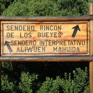
The first National Park of the Metropolitan Region of Santiago is located only 31 kilometers (19 miles) from the city, and it invites you to walk through the Aliwén Mahuida interpretive trail, a 1.7 km (1 mi) route suitable for all visitors, although it is not recommended for the elderly in diminished conditions, nor for people with serious physical disabilities or those who require a wheelchair.
This route is a good example of green tourism in the Santiago Metro area, as it has managed to preserve a sample of the Mediterranean ecosystems typical of the foothills and mountains around the city, ensuring their biodiversity and evolutionary processes, and showing nature’s high resilience and capacity for recovery.
You will find information about the species of flora, birds, mammals, reptiles and amphibians that are now protected by the park’s conservation programs to avoid their extinction. Green tourism within easy reach of the city!

@rioclarillo
DARWIN FROG TRAIL

Foto: Chile Travel
The Darwin frog is only 3 centimeters long and is the star of the interpretative trail that takes its name. It is located inside the Pumalín Douglas Tompkins National Park, to the south of the city of Chaitén, in the Chilean Patagonia.
Located in the Amarillo sector, within the 400,000 hectares of the green Pumalin Park. The Darwin Frog Interpretive Trail is the easiest and most direct route to get inside the heart of the forest and see the great variety of animal and plant species that live there.
You’ll be surprised by the large number of mañíos, trees with sharp leaves (podocarpus nubigenus), the giant Chilean rhubarb (gunnera tinctoria), as well as a great variety of intense green lichens and ferns. And if you’re lucky, if you pay close attention, and have a bit of patience, you might get to see the little Darwin frog.
FRAY JORGE: THE EVERGREEN HYDROPHILLIC FOREST TRAIL IN THE DESERT
Imagine visiting a Valdivian forest with abundant and lush green vegetation, but next to one of the most arid deserts in the world. The Fray Jorge National Park, located near the city of Ovalle in the north of Chile, has a peculiar microclimate that allows thousands of visitors to admire a beautiful oasis.
Fray Jorge has an extraordinary interpretive trail that you simple cannot miss, called the “Hydrophilic Forest Trail”, which is a kilometer long and where you will observe the passage from a small and rich semi-arid ecosystem to a Valdivian or Andean-Patagonian forest ecosystem.
This place is the northernmost remnant of the Valdivian rainforest, which was isolated from the rest of the temperate forest at the end of the last glaciation and is kept alive by the “Camanchaca”, a type of coastal fog that is produced by the Humboldt Current and the sea wind.

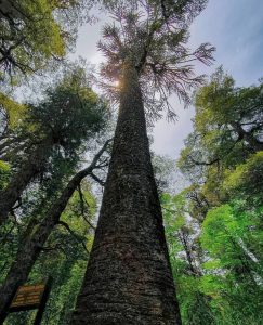
LOS CARPINTEROS TRAIL: DISCOVER THE MOTHER OF THE ARAUCARIAS
In the south of Chile, between volcanoes and araucaria trees, Conguillío National Park is waiting for you with many green tourism experiences that, of course, involve interpretive trails. This place has been recognized as one of the world’s last refuges to preserve landscapes that once were home to dinosaurs and that today is South America’s second largest geopark, declared as such by the UNESCO.
Conguillío means “water with pine nuts” in Mapuche language. It is located in the Region of La Araucanía, 148 km (92 miles) to the northeast of Temuco. Among its many attractions, the impressive Llaima Volcano stands out with its over 3 thousand meters.
During your visit we recommend that you visit the Los Carpinteros interpretive trail, a 6-kilometer, low difficulty, one-way walk that takes about 2.5 hours to hike. The route starts at the park’s information center and crosses forests with thousand-year-old araucarias, lengas, and coigues all the way to Captren Lagoon.
On the way, stop at the informative signs to learn more about the local flora and fauna, and silently watch and listen to the woodpeckers drilling on the trees nearby. Continue your journey and you’ll arrive to the Araucaria Madre, the mother of the Araucarias, a tree that is over a thousand years old and has a thick trunk about 2 meters in diameter.
@parqueconguillio
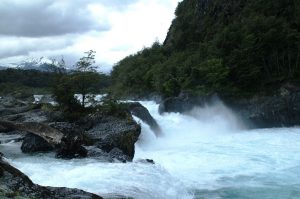
A STOP AT THE PETROHUÉ WATERFALLS
To get to the Vicente Pérez Rosales National Park, the oldest in Chile, you can go from the city of Puerto Montt, about 70 kilometers away (43 miles), or from any point around the Llanquihue Lake, which marks the starting point for this exceptional route that will leave you breathless.
Once inside the Park, in the area of the Petrohué River Falls, you’ll be able to follow the Carilemu interpretive trail, which is 1.6 km long and can be explored in approximately 40 minutes, although we recommend that you take your time to thoroughly explore and enjoy this impressive natural environment.
The interpretive trail is very well designed, so as you walk you will find clear and simple information that explains everything around you in detail. Little by little you will approach the water rapids of Los Saltos del Petrohué and see the rich emerald color that will truly amaze you, while in the background the evergreen forest will be the perfect frame for your pictures with its native trees such as the canelo, coigües, pitras and pataguas.
These interpretive trails are designed to connect you with the surrounding nature, helping you learn and observe every part of the beauty in this country. These trails aim to attract and capture your curiosity, develop your interest and help you establish a lasting bond with the places you visit, giving you a little more knowledge than you had before.